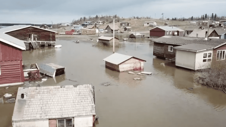
The water levels in Fort Good Hope dropped significantly overnight Tuesday, allowing residents a sigh of relief as the community prepares for phase two of its emergency plan.
The river is flowing with no ice congestion and land is becoming more visible, says Arthur Tobac, emergency communications officer.
A total of 38 residents were evacuated from the valley yesterday evening, following the rapid rise in water levels on May 24.
“We’re gonna have to continue looking after them,” says Tobac.
Although the water is receding, Tobac says “it’s too early to say” when the clean-up effort will be complete.
In the meantime, Tobac and the emergency team are focused on the wellness and care of their members, making sure they are well-informed and fed.
The emergency team had opened up an evacuation centre to host evacuees within the community, according to a territorial public safety notice dated May 25.
“The community remains on high risk,” reads the notice.
Roger Plouffe is the emergency coordinator for the community.
“We still don’t know what the river is going to do yet,” he says. “We can’t get too ahead of ourselves.”
Entering phase two of the emergency plan requires damage assessment to homes and the filling of claim forms for those affected.
“There’s still too much water and we’re still uncertain whether it’s got into some of the systems,” Tobac says.
“(We’re) uncertain when (residents) are going to get back into their homes.”
Doug Prendergast is the spokesperson for the Northwest Territories Power Corporation (NTPC).
NTPC sent additional staff to the community yesterday afternoon, he says.
“Buildings are re-energized when it is safe to do so. As water recedes, customers will have their power restored.”
It is unclear what water level would be appropriate to give power back to the heavily affected areas.
“Some buildings impacted by flooding will need to be inspected and approved by an electrical inspection before they can be re-energized,” says Prendergast.
The emergency team will continue to monitor the situation as levels fluctuate, says Tobac.
He added the area of town nearest the creek is “still underwater.”
The community town hall is providing food to residents at this time and the local radio station will continue to provide daily updates.
According to a territorial public safety notice, water level surveying is to be completed in Hay River, Kátł’odeeche First Nation, Jean Marie River, Fort Simpson, Fort Good Hope.


