“Not being able to get out is the biggest fear that we heard,” says Tammy Neal, Jean Marie River’s SAO, at a public meeting.
Out of roughly 85 residents, 22 members of Jean Marie River gathered earlier this week to discuss the community’s plan for another wildfire season.
With new fires popping up around the region daily, some residents are starting to feel anxious.
“People are afraid to get boxed in because there would be no way out,” says Neal.
“Except for the water but there are not enough boats.”
In the event of an evacuation, Neal says, they were assured by government officials that the community would be flown out before the situation became imminent.

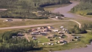
The community of Jean Marie River has a population of 85 people. (Photo courtesy MACA/GNWT)
“I’m feeling a little bit antsy,’ she says, “if it happens we have to have a clear mind.”
However, when CKLB asked if there was another course of action to follow if planes were unable to take off and roads were blocked, Neal said that “we would likely have to evacuate by boat.”
Neal notes that the fire season coming in hot so early has proved challenging for the community’s preparedness efforts. Due to a fire (southwest of Fort Liard) over the weekend, several communities, including Jean Marie River lost service and were left in the dark for hours.
“Even though it was a scare,” she says, “It was also a wakeup call; that we really need to update our communication systems.”
The community has since updated their communications and completed a large mulching project around major infrastructure like the airport, water reservoir and access road.
As of Wednesday afternoon, the closest risks to Jean Marie River were 40 km to the southwest and 70 km to the southeast.
The former is a fire (FS005) near Check Point on Highway 1 at the Liard junction.
It is currently 22 hectares in size. Some rain showers on Tuesday have helped prevent any significant growth. Heavy equipment and crews will be working to further contain the fire along the highway.
The latter is an overwinter fire on Highway 1 (FS004) between the Fort Providence junction and Highway 7 junction that’s burning in various locations on both sides of the road.
NWT Fire stated two structures have been razed by the blaze. Other properties are in the fire’s path and could burn.
The Department of Infrastructure’s highway map now shows Highway 1 west of the Highway 3 intersection to Fort Simpson highway as being open after the fire forced its closure two days ago.
However, there are warnings along the route for thick smoke, poor visibility and heavy equipment at work.
Road closures can happen at any time with little notice. Motorists should take this into consideration when planning their trips in the Dehcho region.


