An assessment on arsenic contamination caused by Giant and Con Mine found the risk to public health to be low around Yellowknife, Dettah and Ndilǫ.
A panel consisting of researchers was held last Thursday to discuss the Legacy Arsenic Health and Human Risk Assessment.
This includes Harriet Phillips, the risk assessment division manager for Canada North Environmental Services (CanNorth). CanNorth is a environmental consulting company, entirely owned by the business arm of the Lac La Ronge Indian Band in Saskatchewan.
The highest levels of arsenic is typically found in the 25 kilometer radius around Yellowknife, Ndilǫ and Dettah.
“There was a large amount of dust that was produced that contained high levels of arsenic,” explains Alex Lynch, the senior advisor with the Department of Environment and Natural Resources, at the start of the panel. “Today we see the impacts from that dust distribution in the area and in the environment.
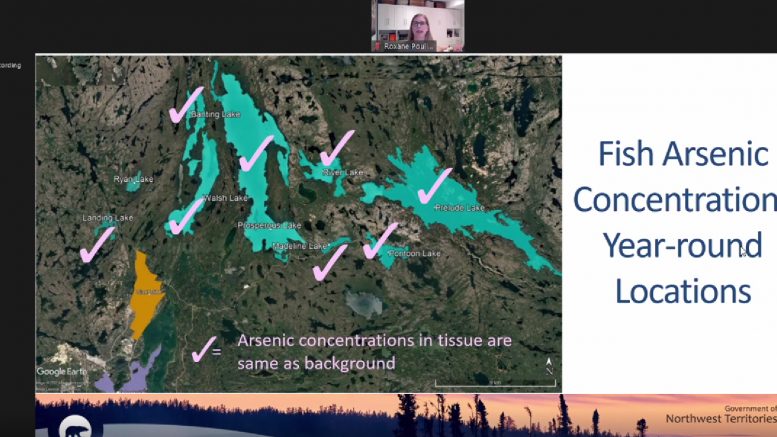
The study examined risks for people living year-round at inland lakes, people participating in activities such as walking, hiking, or swimming and traditional use of areas for hunting, fishing, and gathering.
The parameters
Overall the assessment found arsenic’s danger to public health to be of “very low risk.”
“So this summary really indicates that people in Yellowknife can safely go about their recreational activities such as camping, hiking, walking and swimming in the areas around Yellowknife and be exposed to very low arsenic risk,” says Harriet Phillips, CanNorth’s risk assessment division manager, during the panel.
Phillips explained the measurements of the arsenic levels.
The very low risk range is measured as one in 10,000 people developing a cancer associated with arsenic in a year, while the low risk range is one in 1000 people.
An online map also looks at the level of arsenic in various bodies of water around Yellowknife, measuring the levels of arsenic as parts per billion (PPB). Anything over 52 PPB is considered an elevated risk, and anything over 10 PPB is considered unsafe to drink. Researchers discouraged drinking from any fresh bodies of water due to other health risks.
The assessment found Long Lake and Cameron River to be safe for swimming and fishing, but above the threshold to be safe for drinking.
Whereas the levels of arsenic in Frame Lake, Jackfish Lake Rat Lake are too high for swimming or fishing, but still can be used for canoeing and hiking in the area.
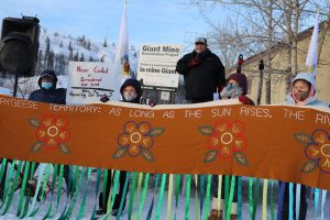
Edward Sangris, Dettah chief of the Yellowknives Dene First Nation,demands an apology and compensation from Giant Mine. (Mariah Caruso/CKLB)
The toxic legacy of Giant Mine
There have been previous human health risk assessments on arsenic around Yellowknife, including one in 2017 as part of the Giant Mine remediation project.
“This [Legacy Arsenic Health and Human Risk Assessment] looked specifically at evaluating what are the risks of health effects to people from exposure to arsenic and other mining related contaminants,” Lynch says. “[The 2017 assessment] didn’t look at the risks for people living in cabins or houses on the inland lakes within the area.”
The Yellowknives Dene First Nation (YKDFN) has been vocal on the toxic legacy of Giant Mine.
Giant Mine operated in Yellowknife between 1948 and 2004, leaving behind 237,000 tonnes of arsenic trioxide stored in underground chambers.
YKDFN expects an apology and compensation from the federal government.
This story has been updated to clarify a quote on the 2017 assessment.