A unified command team consisting of Alberta and NWT – with representation from the Tthebatthı Dënesųłiné First Nation (formerly known as Smith’s Landing) — governments will be responsible for managing the large Tulip Lake Wildfire, 28 kilometres east of Fort Smith.
Currently, additional crews, aircraft and other resources are forming to manage the fire, stated a release from NWT Fire.
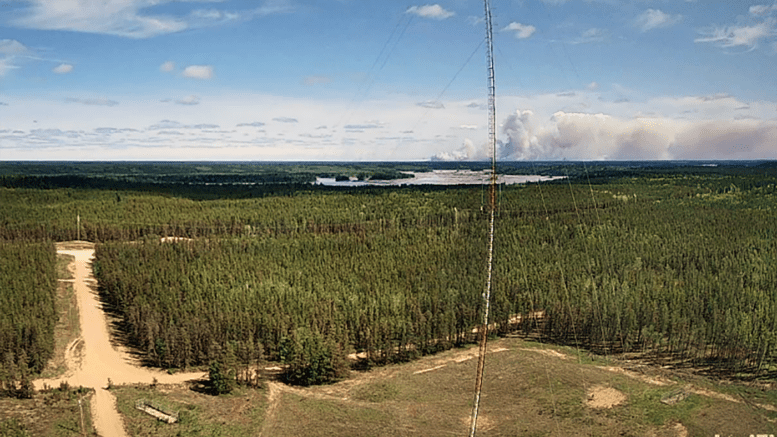
![]() The Tulip Lake (SS009) blaze showed increased activity in the afternoon of June 2nd, due to strong gusting winds. The May 30 lightning caused fire was at 6,545 hectares as of Wednesday morning.
The Tulip Lake (SS009) blaze showed increased activity in the afternoon of June 2nd, due to strong gusting winds. The May 30 lightning caused fire was at 6,545 hectares as of Wednesday morning.
A high-volume sprinkler is staged in Fort Smith, ready for deployment. The fire does not pose any threat to “any known structures,” NWT Fire stated.
Fort Smith Protective Services is assisting with structure protection as required.
This includes deployment of structural protection on both sides of the border, as the fire continues to show increased activity.
There are currently no evacuation notices, alerts, or orders related to the Tulip Lake Wildfire.
More recent updates:
DEHCHO REGION:
FS002 (30 kilometres Southwest of Sambaa k’e): This lightning-caused fire has grown to 2,800 hectares and is out of control. Crews are setting up sprinklers on cabins which may be threatened. There is no threat to the community of Sambaa k’e at this time.
FS003- (14 kilometres North of the BC Border): This lightning-caused fire is approximately 250 hectares in size. Crews continue their work to limit the fire’s growth. There is no risk to cabins, infrastructure or communities.
FS004 (13 kilometres North of the BC Border): This fire is currently holding at 1 hectare in size and is now under control. Crews will continue to work this fire to ensure there are no hot spots before calling it extinguished.
SOUTH SLAVE REGION:
SS007 (24 kilometres northwest of Fort Smith, along the Slave River): The fire remains at 325 hectares. Crews continue to make progress against the fire and set up sprinklers on cabins and structures as needed.
SS008 (Cameron Hills): This fire, 13 kilometres west of Highway 1, is estimated to be 11,358 hectares in size. No threats to communities, cabins, or infrastructure at this time. Crews will continue to monitor the fire and deploy structure protection as required. Travellers along Highway 1 may see smoke from this fire.
NORTH SLAVE REGION
ZF005 (Approx. 2.5 kilometres south of Jennejohn Lake, 15kilometres south of Highway 4 (Ingraham Trail), 28kilometres east of Dettah): This fire is now under control thanks to the swift and effective action by crews and aircraft. There is no threat to values in the area.


